Overview
Researchers from Crawford Hydrology Laboratory are conducting dye tracing studies of the Great Onyx Basin in Mammoth Cave National Park, Kentucky, to enhance our understanding of karst hydrogeology and lay the groundwork for future studies on sustainable practices in the park and the role of karst landscapes in the carbon cycle.
Challenge
Extensive dye tracing studies in the 1970s and 80s mapped and defined the majority of karst geography in Kentucky’s Mammoth Cave National Park. But one area of the park received little attention until the early 2000s. Crawford Hydrology Laboratory, part of Western Kentucky University’s Applied Research & Technology Program, is continuing dye tracing studies in the Great Onyx Groundwater Basin to develop a high-resolution model of the “internal plumbing” of the aquifer.
This kind of three-dimensional model can’t be achieved using qualitative methods alone. Charcoal monitoring only provides point-to-point connections and grab sampling requires significant effort for lower-resolution data. Continuous monitoring, on the other hand, offers insight into the exact time of travel and dye mass recovery and allows researchers to interpret the breakthrough curve for other aquifer characteristics. In order to further characterize and map Great Onyx Basin, Crawford Hydrology Laboratory needed a method of continuous data collection that would provide high-resolution data while reducing effort and cost in the field and at the lab.
This kind of three-dimensional model can’t be achieved using qualitative methods alone. Charcoal monitoring only provides point-to-point connections and grab sampling requires significant effort for lower-resolution data. Continuous monitoring, on the other hand, offers insight into the exact time of travel and dye mass recovery and allows researchers to interpret the breakthrough curve for other aquifer characteristics. In order to further characterize and map Great Onyx Basin, Crawford Hydrology Laboratory needed a method of continuous data collection that would provide high-resolution data while reducing effort and cost in the field and at the lab.
Solution
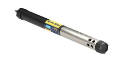
To get the quantitative data they need, Crawford Hydrology Lab and students from Western Kentucky University set up an Aqua TROLL 600 at Great Onyx Spring, which had been established as a resurgence point for Great Onyx Basin by previous dye tracing studies. The Aqua TROLL was equipped with pH, specific conductivity, temperature, pressure, and fluorescein and rhodamine WT sensors. The team then injected fluorescein and rhodamine dye at different points in the cave and used the data from the Aqua TROLL to track the dye’s timing and breakthrough at Great Onyx Spring.
“This project was to understand and better define the surface area that is contributing water to Great Onyx Basin,” says Bledsoe, “Through dye tracing we can come up with a very accurate, three-dimensional map of the basin, which then leads to better predictive models for geochemical processes.”
During the two months the Aqua TROLL was deployed, the team worked without a telemetry station, using the VuSitu mobile app to transfer their data.
“Using Bluetooth makes data collection easy because we don’t have to take a laptop or cables out to the site,” says Bledsoe. “We don’t have cell service at the spring, but after a hike to the top of the ridge, you can text or email your data to yourself or a colleague. You can secure your data pretty quickly.”
Both the Aqua TROLL and the fluorescent sensors worked well for the project. “I like the design of the actual sensors themselves. They’re just really easy to use,” says Bledsoe.
The Aqua TROLL was similarly user-friendly. “I’m in love with it,” Bledsoe says. “It’s a robust sonde, which we need in these types of environments.”
Results
Bledsoe reports that the Aqua TROLL has allowed the Crawford Hydrology Lab to collect high-resolution data, which has helped with more precise timing of initial dye detection and led to new insights in mapping the Great Onyx Basin.
The data from dye tracing studies like this one form the basis not only for future research on karst geography in the area, but also for decision making around park policies and sustainable land use.
Bledsoe sites dye tracing as the foundation for a recent study on trail use impact that tracked the effects of horses, bikes and pedestrians on groundwater quality. “This directly informs things that the park is doing as far as resource and land management,” Bledsoe says, “But the reason we know what’s going on in the basins is because they were dye traced first. All of this work builds upon dye tracing.”
Another area of special interest to students working with Crawford Hydrology Laboratory is the role karst landscapes play in the carbon cycle. And mapping the basins is the first step in understanding how geochemical processes play out in these areas.
“If we can know what's going on in one particular basin, then maybe we can understand how karst processes are affecting carbon cycling on a larger scale,” Bledsoe says. “The more we can learn, the more we can look ahead at vulnerabilities created by climate change and ask, ‘How do we come up with nature-based solutions?’ Looking at karst geochemistry is just one piece of that big puzzle.”