Overview
Challenge
Karst aquifers form when rainwater or groundwater seeps into fissures in soluble rock and begins to dissolve the carbonate minerals within it. Gradually, channels and conduits form, allowing water to flow from the surface through underground caves, resurfacing from a different cave mouth, or from a well.
Karst aquifers provide the drinking water supply for half of the population of Slovenia, and a third of the population of Europe.
As such an important water source, getting an accurate picture of the path of water through these caves is crucial. If a pollutant enters the aquifer through a channel at the surface, public health officials need to know where the pollutant is likely to resurface and after how long, to secure the public’s access to safe drinking water.
Dr. Franci Gabrovšek, Principal Research Associate at the Karst Research Institute in Slovenia, reports that monitoring and forecasting water flow through karst aquifers is uniquely challenging. “In normal aquifers you can put in a set of wells,” he says, “You can monitor those wells and sooner or later you end up with a reliable model of the velocity and direction of groundwater.”
But this system doesn’t work for karst aquifers.
When water enters the initial fractures in the aquifer, it dissolves soluble bedrock as it passes through. This results in the formation of complex networks of caves called conduits, which evolve over thousands to millions of years under changing environmental and tectonic conditions.
The shape and position of these conduits is unpredictable, and because most are inaccessible, the geometry of the overall networks is not well known.
“We only know what we have explored,” Gabrovšek explains, “or what cavers have seen and mapped.” We’ll never be able to directly monitor every part of a karst aquifer, making them especially difficult to characterize.
The broad network of passageways means the path of water through the aquifer can vary dramatically with changes in water level. “It may well happen that at some water level two spots might be connected, but at a higher or lower water level they are not connected at all,” Gabrovšek says, “The flow might be diverted to somewhere completely different.”
These features present big problems for tracking and forecasting pollution. If a pollutant enters the catchment, it could reach a spring or well within hours or days. But, depending on which conduits it travels through and the volume of water flowing with it, it could also remain in the aquifer for years, resurfacing at a much later date.
The Karst Research Institute’s ultimate goal is to collect enough data to build a digital model that can accurately predict how water travels through these aquifers and where and when it might emerge.
Solution
Because karst aquifers are so complex and varied, continuous monitoring is essential to this process. “One event simply doesn't tell you enough,” Gabrovšek explains, “That’s why we need long-term observation.”
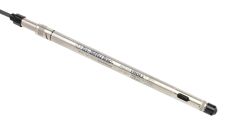
Variation in cave characteristics and accessibility means that the team needs a range of devices to suit different conditions. In a typical location, they install an Aqua TROLL 100 or 200 to measure conductivity, temperature and depth alongside a Level TROLL to track fluctuations in water level.
At more accessible locations, an Aqua TROLL 600 connected to VuLink transmits data remotely to the cloud, where it enters their data collection system. But past a certain depth this becomes impossible. For those locations, the team uses a Rugged TROLL to log data offline until they can return to the site to download it.
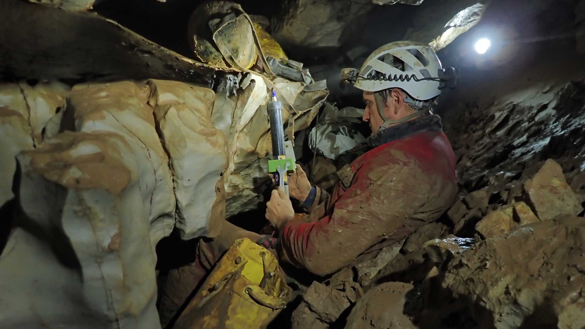
Installations are time-consuming, strenuous trips. Gabrovšek and his team often have to travel deep underground to install instrumentation in locations they haven’t yet mapped, descending hundreds of meters of rope, swimming through partially flooded areas and climbing or crawling through arduous terrain, all without knowing what they will find.
They bring camping equipment because, Gabrovšek notes, “It might take hours or even days to reach the monitoring spot.” On some trips, specialized divers accompany them to install instruments in completely flooded passages.

Carrying limited resources under demanding physical conditions, Gabrovšek and the team need to be able to count on their instrumentation. In hard-to-reach places, it’s essential that the equipment works well when they set it up and keeps working. “There are spots which could be left unattended for a year or more because they might be inaccessible. That means we really rely on the stability of the instrument,” Gabrovšek says.
The rugged, low-maintenance design of In-Situ’s equipment has allowed Gabrovšek and his team to reduce the frequency of these arduous field visits.
Where telemetry is an option, they can trust VuLink to alert them if there’s a problem with the installation, and plan caving trips only as necessary, saving valuable time and effort on routine maintenance.
Gabrovšek notes that, before telemetry, “you could come back after a year and realize the battery is gone.” For sites that demand strenuous travel, that loss of data is even more disappointing.
Results
The team uses their research to support the most effective legislative measures based on what they know of the aquifer.
“I really do spend a lot of time just looking at data,” Gabrovšek says of his day-to-day work, “But that really can tell you a lot. In the last couple of decades, we've really made a big step forward in understanding these aquifers.”
The quality of the data is key to the team’s ability to fulfill its mission. For example, they look to fluctuations in temperature to indicate the time it takes water to travel through conduits. The high resolution of In-Situ instruments helps enable this work.
“If you take temperature, for example,” Gabrovšek explains, “you have instruments which do not have very high resolution compared to In-Situ. And that might be okay for many applications. But in our case, you might have temperature oscillations within .3 or .4 Centigrade or Kelvin. And in that region, it matters whether your resolution is high. If you have good resolution, you're in a good place to reconstruct something.”
Gabrovšek says they’re looking to expand their network of In-Situ instruments; “In-Situ provides a good solution for the demands of our work.”